Jerusalem , Israel


Jerusalem (Hebrew: יְרוּשָׁלַיִם‎ (audio) (help·info), Yerushaláyim; Arabic: القُدس (audio) (help·info), al-Quds)[ii] is the capital[iii] of Israel and its largest city[2] in both population and area,[3] with 732,100 residents in an area of 125.1 square kilometres (48.3 sq mi) if disputed East Jerusalem is included.[1][4][iv] Located in the Judean Mountains, between the Mediterranean Sea and the northern tip of the Dead Sea, modern Jerusalem has grown up outside the Old City.

clip_image001[10]
View of Jerusalem from the Mount of Olives
by Juancri, http://commons.wikimedia.org/wiki/Image:JerusalemFromMountOfOlives.JPG, and used under GNU Free Documentation License

The city has a history that goes back to the 4th millennium BCE, making it one of the oldest cities in the world.[5] Jerusalem has been the holiest city in Judaism and the spiritual center of the Jewish people since the 10th century BCE,[6] contains a number of significant ancient Christian sites, and is considered the third-holiest city in Islam.[7] Despite having an area of only 0.9 square kilometer (0.35 square mile),[8] the Old City is home to sites of key religious importance, among them the Temple Mount, the Western Wall, the Church of the Holy Sepulchre, the Dome of the Rock and al-Aqsa Mosque. The old walled city, a World Heritage site, has been traditionally divided into four quarters, although the names used today — the Armenian, Christian, Jewish, and Muslim Quarters — were introduced in the early 19th century.[9] The Old City was nominated for inclusion on the List of World Heritage Sites in danger by Jordan in 1982.[10] In the course of its history, Jerusalem has been destroyed twice, besieged 23 times, attacked 52 times, and captured and recaptured 44 times.

clip_image001[6]
View of Jerusalem from the roof terrace of the Austrian Hospice
Copyright Guggani, http://commons.wikimedia.org/wiki/Image:Austrian_Hospice_Jerusalem_April_2007.JPG, used under Creative Commons Attribution ShareAlike 1.0 License

Religious significance

clip_image001

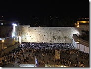
The Western Wall, known as the Kotel

clip_image003

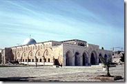
The al-Aqsa Mosque, the third holiest place in Islam

Jerusalem plays an important role in Judaism, Christianity, and Islam. The 2000 Statistical Yearbook of Jerusalem lists 1204 synagogues, 158 churches, and 73 mosques within the city.[134] Despite efforts to maintain peaceful religious coexistence, some sites, such as the Temple Mount, have been a continuous source of friction and controversy.

clip_image004

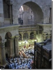
Church of the Holy Sepulchre

Jerusalem has been sacred to the Jews since King David proclaimed it his capital in the 10th century BCE. Jerusalem was the site of Solomon's Temple and the Second Temple.[6] It is mentioned in the Bible 632 times. Today, the Western Wall, a remnant of the wall surrounding the Second Temple, is a Jewish holy site second only to the Holy of Holies on the Temple Mount itself. Synagogues around the world are traditionally built with the Holy Ark facing Jerusalem and Arks within Jerusalem face the "Holy of Holies". As prescribed in the Mishna and codified in the Shulchan Aruch, daily prayers are recited while facing towards Jerusalem and the Temple Mount. Many Jews have "Mizrach" plaques hung on a wall of their homes to indicate the direction of prayer.

clip_image001[8]
Western wall of Jerusalem
by Wayne McLean, http://commons.wikimedia.org/wiki/Image:Western_wall_jerusalem_night.jpg, used under Creative Commons Attribution ShareAlike 2.0 License

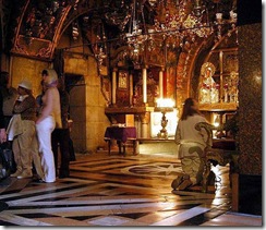
Christianity reveres Jerusalem not only for its Old Testament history but for its significance in the life of Jesus. According to the New Testament, Jesus was brought to Jerusalem soon after his birth and later in his life cleansed the Second Temple. The Cenacle, believed to be the site of Jesus' Last Supper, is located on Mount Zion in the same building that houses the Tomb of King David.Another prominent Christian site in Jerusalem is Golgotha, the site of the crucifixion. The Gospel of John describes it as being located outside Jerusalem,[143] but recent archaeological evidence suggests Golgotha is a short distance from the Old City walls, within the present-day confines of the city.[144] The land currently occupied by the Church of the Holy Sepulchre is considered one of the top candidates for Golgotha and thus has been a Christian pilgrimage site for the past two thousand years.
clip_image002
Golgotha Hill, inside the Church of the Holy Sepulchre
by Wayne McLean, http://commons.wikimedia.org/wiki/Image:Golgotha_hill.jpg, and used under Creative Commons Attribution ShareAlike 2.0 License

Jerusalem is considered the third-holiest city in Islam.[7] For approximately a year, before it was permanently switched to the Kabaa in Mecca, the qibla (direction of prayer) for Muslims was Jerusalem. The city's lasting place in Islam, however, is primarily due to Muhammad's Night of Ascension (c. 620 CE). Muslims believe Muhammad was miraculously transported one night from Mecca to the Temple Mount in Jerusalem, whereupon he ascended to Heaven to meet previous prophets of Islam. The first verse in the Qur'an's Surat al-Isra notes the destination of Muhammad's journey as al-Aqsa (the farthest) mosque, in reference to the location in Jerusalem. Today, the Temple Mount is topped by two Islamic landmarks intended to commemorate the event — al-Aqsa Mosque, derived from the name mentioned in the Qur'an, and the Dome of the Rock, which stands over the Foundation Stone, from which Muslims believe Muhammad ascended to Heaven.

clip_image001[12]
The Western Wall with the Dome on the Rock in the background, Jerusalem.
by Nadavspi, http://commons.wikimedia.org/wiki/Image:WestWall-dome.jpg, and used under Creative Commons Attribution ShareAlike 1.0 License


Transportation

clip_image005

clip_image002[3]

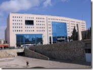
Jerusalem's Central Bus Station

The airport nearest to Jerusalem is Atarot Airport, which was used for domestic flights until its closure in 2001. Since then it has been under the control of the Israel Defense Forces due to disturbances in Ramallah and the West Bank. All air traffic from Atarot was rerouted to Ben Gurion International Airport, Israel's largest and busiest airport, which serves nine million passengers annually.

Egged Bus Cooperative, the second-largest bus company in the world, handles most of the local and intercity bus service out of the city's Central Bus Station on Jaffa Road near the western entrance to Jerusalem from highway 1. As of 2008, Egged buses, taxicabs and private cars are the only transportation options in Jerusalem. However, this will change with the completion of the Jerusalem Light Rail, a new rail-based transit system currently under construction. The rail system will be capable of transporting an estimated 200,000 people daily. It will have 24 stops, and is scheduled for completion in January 2009.

clip_image006

clip_image002[4]

Begin Expressway.

Another work in progress is a new high-speed rail line from Tel Aviv to Jerusalem, which is scheduled to be completed in 2011. Its terminus will be an underground station (80m deep) serving the national Convention centre and the Central Bus Station, and is planned to be extended eventually to Malha station. Israel Railways operates train services to Malha train station from Tel Aviv via Beit Shemesh.

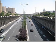
Begin Expressway is one of Jerusalem's major north-south thoroughfares; it runs on the western side of the city, merging in the north with Route 443, which continues toward Tel Aviv. Route 60 runs through the center of the city near the Green Line between East and West Jerusalem. Construction is progressing on parts of a 35-kilometer (22-mile) ring road around the city, fostering faster connection between the suburbs. The eastern half of the project was conceptualized decades ago, but reaction to the proposed highway is still mixed.

Map of Jerusalem

Image:Jerusalem Israel Map.png

The Carlton Gardens


The Carlton Gardens is a World Heritage Site located on the northeastern edge of the Central Business District in the suburb of Carlton, in Melbourne, Victoria, Australia.

The 26 hectare (64 acre) site contains the Royal Exhibition Building, Melbourne Museum and Imax Cinema, tennis courts and an award winning children's playground. The rectangular site is bound by Victoria Street, Rathdowne Street, Carlton Street, and Nicholson Street. From the Exhibition building the gardens gently slope down to the southwest and northeast. According to the World Heritage listing the Royal Exhibition Buildings and Carlton Gardens are "of historical, architectural, aesthetic, social and scientific (botanical) significance to the State of Victoria."

The gardens are an outstanding example of Victorian era landscape design with sweeping lawns and varied European and Australian tree plantings consisting of deciduous English oaks, White Poplar, Plane trees, Elms, Conifers, Cedars, Turkey Oaks, Araucarias and evergreens such as Moreton Bay Figs, combined with flower beds of annuals and shrubs. A network of tree lined paths provide formal avenues for highlighting the fountains and architecture of the Exhibition building. This includes the grand allee of plane trees that lead to the exhibition building. Two small ornamental lakes adorn the southern section of the park. The northern section contains the Museum, tennis courts, maintenance depot and curator's cottage, and the children's playground designed as a Victorian maze.

The listing in the Victorian Heritage Register says in part:

"The Carlton Gardens are of scientific (botanical) significance for their outstanding collection of plants, including conifers, palms, evergreen and deciduous trees, many of which have grown to an outstanding size and form. The elm avenues of Ulmus procera and Ulmus × hollandica are significant as few examples remain world wide due to Dutch elm disease. The Garden contains a rare specimen of Acmena ingens, only five other specimens are known, an uncommon Harpephyllum caffrum and the largest recorded in Victoria, Taxodium distichum, and outstanding specimens of Chamaecyparis funebris and Ficus macrophylla, south west of the Royal Exhibition Building."

clip_image001

Wildlife includes possums, ducks and ducklings in spring, Tawny Frogmouths, and other urban environment birds.

The gardens contain three important fountains: the Exhibition Fountain, designed for the 1880 Exhibition by sculptor Joseph Hochgurtel; the French Fountain; and the Westgarth Drinking Fountain.

clip_image001[4]

Carlton Gardens south

History

  • 1839 - Large tracts of land surrounding the original town grid of Melbourne were reserved from sale by Superintendent Charles La Trobe. Most of this land was later sold and subdivided or used for the development of various public institutions, but a number of substantial sites were permanently reserved as public parks, including the Carlton Gardens as well as Flagstaff Gardens, Fitzroy Gardens, Treasury Gardens and Kings Domain.
  • Circa 1856 - The City of Melbourne obtained control of the Carlton Gardens, and engaged Edward La Trobe Bateman to prepare a design for the site. The path layout and other features of the design were built although limitations on funding for maintenance etc. resulted in frequent criticism.
  • 1870s - The colonial Victorian Government resumed control of the Gardens and minor changes and were made under the direction of Clement Hodgkinson. The site was soon afterwards drastically redesigned for the 1880 Melbourne International Exhibition by the architect Joseph Reed. The prominent local horticulturist William Sangster was engaged as a contractor to redevelop the gardens.
  • 1880 - Exhibition Building completed for the Melbourne International Exhibition that year. Temporary annexes to house some of the exhibition in the northern section were demolished after the exhibition closed on 30 April, 1881.
  • 1891 - The curator's Lodge was completed and lived in by John Guilfoyle.
  • 1901 - First Parliament of Australia opens in the Exhibition Building. The west annex of the Building becomes the site of the Victorian Parliament for the next 27 years.
  • 1948 to 1961 - part of the complex was used as a migrant reception centre.
  • 2001 - Taylor Cullity Lethlean with Mary Jeavons wins a landscape award for design and building a new children's playground of elegant yet robust resolution. The Jury described the design as a distinctive and unified design that respects its historic setting and addresses the demands of creative play for spatial and visual variety.
  • July 2004 - After several years of lobbying by the Melbourne City Council, The Royal Exhibition Building and Carlton Gardens, Melbourne, were inscribed on the World Heritage List at the 28th session of the World Heritage Committee held in Suzhou, China.

The Exhibition Building is still used for exhibitions, including for the annual Melbourne International Flower and Garden Show. The Melbourne Exhibition and Convention Centre, opened in 1996 at Southbank, provides more modern facilities and has become Melbourn'e prime location for exhibitions and conventions. It also hosts the exams for University of Melbourne in recent years.

Christ the Redeemer Statue, Brazil


Christ the Redeemer, or Cristo Redentor, is a 32m tall statue in Rio de Janeiro, Brazil. It sits at the top of the 710m (2330ft) Corcovado mountain, in the Tijuca Forest National Park, overlooking Rio de Janeiro. The idea to put a statue at the top of Corcovado can be traced back to the mid 1850s, but was dismissed when Brazil became a republic in 1889, and a law was put in place separating the church from the state. It wasn't until 1921 that the idea of building a statue was revisited. This time, it was spearheaded by the Archdiocese of Rio de Janeiro, which organised a fund raising for it. Donations came mostly from the Brazilian Catholic community. Among the designs proposed included a cross, a statue of Christ holding a globe, and a pedestal representing the world. Eventually the design of Christ with open arms was chosen. As with many structures from the 1920's, the statue was designed in the Art Deco style which was all the rage then. The monument was sculptured by French sculptor Paul Landowski. Engineer Heitor da Silva Costa oversaw the project. The team of engineers and technicians decided to construct the statue of reinforced concrete, and clad its outer layer in soapstone, which has high resistance to extreme weather. The stones came from Limhamn, in Malmö, Sweden.

clip_image002
Aerial view of Cristo Redentor, the statue of Christ the Redeemer, Rio de Janeiro, Brazil
by Klaus with K, http://commons.wikimedia.org/wiki/Image:Corcovado_statue01_2005-03-14.jpg, used under GNU Free Documentation License

The statue of Christ the Redeemer was inaugurated on 12 October 1932 by Brazilian president Getúlio Vargas in a lavish ceremony. In October 2006, in celebration of the 75th anniversary of the statue, the Archbishop of Rio de Janeiro Cardinal Eusebio Oscar Scheid consecrated a chapel under the statue so that Catholics can hold baptisms and weddings there. The chapel can accommodate 150 people at any one time.

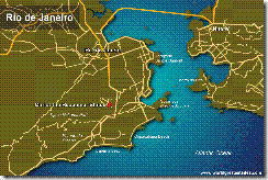
Where in the world is Christ the Redeemer Statue?

clip_image001
Location of Christ the Redeemer Statue in Rio de Janeiro, Brazil

How to go to Christ the Redeemer Statue ?

You can take a taxi right to the top, or catch the small red train that goes up the hill. Buy the tickets at Rua Cosme Velho 513. The train goes right to the foot of the statue, and you get the stunning panoramic view of Rio de Janeiro spread out before you. The journey takes 17 minutes and the train leave every 30 minutes.

At the top statue, you still need to climb some stairs to reach the base of the statue. The view at the top is simply stunning. You can see Copacabana, Ipanema, Leblon, the Botanical Gardens, and more. At night the scenery becomes glittering with hundred of thousands of lights illuminating the city.


clip_image002[4]


Another aerial view of Cristo Redentor, the statue of Christ the Redeemer, Rio de Janeiro, Brazil
by Jcsalmon, http://commons.wikimedia.org/wiki/Image:Cristo_Redentor_Rio_de_Janeiro_4.jpg, used under GNU Free Documentation License

Iguazu Falls, Argentina

Iguazu Falls, also written Iguassu Falls or Iguaçu Falls in Portuguese and Cataratas del Iguazú in Spanish, is one of the biggest waterfalls in the world. It is located on the border of Iguazu Falls and Argentina, and close to the border with Paraguay. Iguazu Falls consist of 270 falls along a 2.7 km stretch between Iguazu Falls and Argentina. Both countries have created national parks around the waterfall, the Iguazú National Park in Argentina and the Iguaçu National Park in Iguazu Falls, both designated Unesco World Heritage Sites in 1984 and 1986 respectively.
The highest drop of Iguazu Falls is 82m (269ft) though the majority of the falls average 64m (210ft). The most impressive section is called Garganta del Diablo (or Garganta do Diabo in Portuguese), or Devil's Throat. This is a U-shaped section, 150m wide, and 700m, that forms the border between Argentina and Iguazu Falls. Although much of Garganta del Diablo is located in Argentina, the view is best from Iguazu Falls.


The first European to discover Iguazu Falls was the Spanish Conquistador Álvar Núñez Cabeza de Vaca. The name Iguazu comes from the native Guarani and Tupi language, meaning "big water" ("ee" = water, "guasu" = big).
The Iguazu Falls is reachable from two main towns, Foz do Iguaçu in the Iguazu Fallsian state of Paraná, and Puerto Iguazú in the Argentine province of Misiones. Other tourist attractions near the falls include the Itaipu hydroelectric power plant, and the Jesuit Missions of the Guaranis in Argentina, Paraguay and Iguazu Falls.

clip_image002

Iguazu Falls, Iguazu Falls & Argentina
by Luca Galuzzi, http://commons.wikimedia.org/wiki/Image:Iguazu_Falls_Cataratas_Argentina_Luca_Galuzzi_2005.jpg, www.galuzzi.it, used under Creative Commons Attribution ShareAlike 2.5


Accommodation

Looking for a hotel room in Iguazu Falls? Try Iguazu Falls Hotels
For budget accommodation in Iguazu Falls, try Budget Accommodation Guide.


Where in the world is Iguazu Falls?

clip_image001

How to go to the Iguazu Falls

The main towns to visit Iguazu Falls are Foz do Iguaçu in Iguazu Falls, Puerto Iguazu in Argentina, and Ciudad del Este, a short distance away in Paraguay (see map above). You can get a flight to go to Foz do Iguaçu from Rio de Janeiro and to Puerto Iguazu from Buenos Aires. Admission to Iguazu Falls is 30AR$ from the Argentinian side, and 20 R$pp on the Iguazu Fallsian side. From the Iguazu Fallslian side, you can get excellent views of the spectacular Garganta do Diabo (which is on the Argentinian side), where the water falls on three sides.

Admission Details

Entrance fees up the Iguazu Falls is 11.50 euros for adults, by elevator to the top. For more details, check out the Iguazu Falls website (see external links below). The tower is opened from 9:30am to 11:45pm every day, with extended hours from 9:00am to 12:45am.

Saint Petersburg

Saint Petersburg (Russian: Санкт-Петербу́рг?·i, tr.: Sankt-Peterburg, Russian pronunciation: [saŋkt pʲɪtʲɪrˈburk]) is a city and a federal subject of Russia located on the Neva River at the head of the Gulf of Finland on the Baltic Sea. The city's other names were Petrograd (Петрогра́д, 1914–1924) and Leningrad (Ленингра́д, 1924–1991). It is often called just Petersburg (Петербу́рг) and is informally known as Peter (Пи́тер).

Founded by Tsar Peter I of Russia on 27 May, 1703, it was the capital of the Russian Empire for more than two hundred years (1713–1728, 1732–1918). Saint Petersburg ceased being the capital in 1918 after the Russian Revolution of 1917.[1] It is Russia's second largest and Europe's fourth largest city (by city limit) after Moscow, London and Paris.[citation needed] The city has 4.6 million inhabitants, and over 6 million people live in its vicinity. Saint Petersburg is a major European cultural center, and an important Russian port on the Baltic Sea.

Saint Petersburg is often described as the most Western European city of Russia.[2] Among cities of the world with over one million people, Saint Petersburg is the northernmost. The Historic Centre of Saint Petersburg and Related Groups of Monuments constitute a UNESCO World Heritage Site. Russia's political and cultural center for 200 years, the city is sometimes referred to in Russia as the northern capital. A large number of foreign consulates, international corporations, banks and other businesses are located in Saint Petersburg.

Transportation

clip_image002

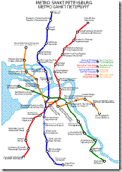
Map of the Saint Petersburg Metro.

clip_image003

The decoration of Saint Petersburg Metro

The city is a major transport hub. The first Russian railroad was built here, in 1837. Today, Saint Petersburg is the final destination of a web of intercity and suburban railways, served by five different railway terminals (Baltiysky, Finlyandsky, Ladozhsky, Moskovsky, and Vitebsky),[42] as well as dozens of non-terminal railway stations within the federal subject. Saint Petersburg has international railway connections to Helsinki, Finland, Berlin, Germany, and all former republics of the USSR. The Helsinki railroad was built in 1870, 443 km (275 mi), commutes three times a day, in a journey lasting about five and a half hours. The Moscow-Saint Petersburg Railway opened in 1851, 651 km (405 mi); the commute to Moscow now requires about four and a half to nine hours.[43] Saint Petersburg is also served by Pulkovo International Airport,[44] and by three smaller commercial and cargo airports in the suburbs. There is a regular, 24/7, rapid-bus transit connection between Pulkovo airport and the city center.

The city is also served by the passenger and cargo seaports in the Neva Bay of the Gulf of Finland, Baltic Sea, the river port higher up the Neva, and tens of smaller passenger stations on both banks of the Neva river. It is a terminus of the Volga-Baltic and White Sea-Baltic waterways. In 2004 the first high bridge that doesn't need to be drawn, a 2,824 m (9,265 ft) long Big Obukhovsky Bridge, was opened. Meteor hydrofoils link the city centre to the coastal towns of Kronstadt, Lomonosov, Peterhof, Sestroretsk and Zelenogorsk from May through October.

Saint Petersburg has an extensive city-funded network of public transport (buses, trams, trolleybuses) and several hundred routes served by marshrutkas. Trams in Saint Petersburg used to be the main transport; in the 1980s, Leningrad had the largest tramway network in the world, but many tramway rail tracks were dismantled in the 2000s. Buses carry up to 3 million passengers daily, serving over 250 urban and a number of suburban bus routes. Saint Petersburg Metro underground rapid transit system was opened in 1955; it now has four lines with 60 stations, connecting all five railway terminals, and carrying 3.4 million passengers daily. Metro stations are decorated in marble and bronze.

Traffic jams are common in the city, because of narrow streets, parking sites along their edges, high daily traffic volumes between the commuter boroughs and the city centre, intercity traffic, and at times excessive snow in winter. Five segments of the Saint Petersburg Ring Road were opened between 2002 and 2006, and full ring is planned to open in 2010.

Saint Petersburg is part of the important transport corridor linking Scandinavia to Russia and Eastern Europe. The city is a node of the international European routes E18 towards Helsinki, E20 towards Tallinn, E95 towards Pskov, Kiev and Odessa and E105 towards Petrozavodsk, Murmansk and Kirkenes (north) and towards Moscow and Kharkiv (south).

Cityscape

clip_image001clip_image002

clip_image001[4]

As of now, Saint Petersburg has no skyscrapers and a relatively low skyline. Current regulations forbid construction of high buildings in the city center. The 310 m tall Saint Petersburg TV Tower is the tallest structure in the city, while the 122.5 m Peter and Paul Cathedral is by far the highest building. However, there is a controversial project endorsed by the city authorities and known as the Okhta Center to build a 396 m supertall skyscraper. In 2008 the World Monuments Fund included the Saint Petersburg historic skyline within the watch list of 100 most endangered sites due to the expected construction, which threatens to alter it drastically.[45]

Unlike in Moscow, in Saint Petersburg the historic architecture of the city center, mostly consisting of Baroque and neoclassical buildings of the 18th and 19th centuries, has been largely preserved, although a number of buildings were demolished after the Bolsheviks' seizure of power, during the Siege of Leningrad and in recent years. The oldest of the remaining building is a wooden house built for Peter I in 1703 on the shore of the Neva near Trinity Square. Since 1991 the Historic Centre of Saint Petersburg and Related Groups of Monuments in Saint Petersburg and Leningrad Oblast have been listed by UNESCO as a World Heritage Site.

The ensemble of Peter and Paul Fortress with the Peter and Paul Cathedral takes dominant position on Zayachy Island along the right bank of the Neva river. Each noon a cannon fires a blank shot from the fortress. The Saint Petersburg Mosque, the largest mosque in Europe when opened in 1913, is situated on the right bank nearby. The spit of Vasilievsky Island, which splits the river into two largest armlets, the Bolshaya Neva and Malaya Neva, is connected to the northern bank (Petrogradsky Island) via the Exchange Bridge and occupied by the Old Saint Petersburg Stock Exchange and Rostral Columns. The southern coast of Vasilievsky Island along the Bolshaya Neva features some of the city's oldest buildings, dating from the 18th century, including the Kunstkamera, Twelve Collegia, Menshikov Palace and Imperial Academy of Arts. It hosts one of two campuses of Saint Petersburg State University.

On the southern, left bank of the Neva, connected to the spit of Vasilievsky Island via the Palace Bridge, lie the Admiralty Building, the vast Hermitage Museum complex stretching along the Palace Embankment, which includes the baroque Winter Palace, former official residence of Russian emperors, as well as the neoclassical Marble Palace. The Winter Palace faces Palace Square, the city's main square with the Alexander Column.

Nevsky Prospekt, also situated on the left bank of the Neva, is the main avenue of the city. It starts at the Admiralty and runs eastwards next to Palace Square. Nevsky Prospekt crosses the Moika (Green Bridge), Griboyedov Canal (Kazansky Bridge), Garden Street, the Fontanka (Anichkov Bridge), meets Liteyny Prospekt and proceeds to Uprising Square near the Moskovsky Rail Terminal, where it meets Ligovsky Prospekt and turns to the Alexander Nevsky Lavra. The Passage, Catholic Church of St. Catherine, Book House (former Singer Manufacturing Company Building in the Art Nouveau style), Grand Hotel Europe, Gostiny Dvor, Russian National Library, Alexandrine Theatre behind Mikeshin's statue of Catherine the Great, Kazan Cathedral, Anichkov Palace and Beloselsky-Belozersky Palace are all situated along that avenue.

The Alexander Nevsky Lavra, intended to house the relics of St. Alexander Nevsky, is an important center of Christian education in Russia. It also contains the Tikhvin Cemetery with graves of many notable Petersburgers.

On the territory between the Neva and Nevsky Prospekt the Church of the Savior on Blood, Mikhailovsky Palace housing the Russian Museum, Field of Mars, St. Michael's Castle, Summer Garden, Tauride Palace, Smolny Institute and Smolny Convent are located.

Many notable landmarks are situated to the west and south of the Admiralty Building, including the Trinity Cathedral, Mariinsky Palace, Hotel Astoria, famous Mariinsky Theatre, New Holland Island, Saint Isaac's Cathedral, the largest in the city, and Decembrists Square with the Bronze Horseman, 18th century equestrian monument to Peter the Great, which is considered among the city's most recognizable symbols.

Other symbols of Saint Petersburg include the weather vane in the shape of a small ship on top of the Admiralty's golden spire and the golden angel on top of the Peter and Paul Cathedral. The Palace Bridge drawn at night is yet another symbol of the city. Every night during the navigation period from April to November, 22 bridges across the Neva and main canals are drawn to let ships pass in and out of the Baltic Sea according to a schedule.[46] It wasn't until 2004 that the first high bridge across the Neva, which doesn't need to be drawn, Big Obukhovsky Bridge, was opened. There are hundreds of smaller bridges in Saint Petersburg spanning across numerous canals and distributaries of the Neva, some of the most important of which are the Moika, Fontanka, Griboyedov Canal, Obvodny Canal, Karpovka and Smolenka. Due to the intricate web of canals, Saint Petersburg is often called Venice of the North. The rivers and canals in the city center are lined with granite embankments. The embankments and bridges are separated from rivers and canals by granite or cast iron parapets.

Southern suburbs of the city feature former imperial residences, including Peterhof, with majestic fountain cascades and parks, Tsarskoe Selo, with the baroque Catherine Palace and the neoclassical Alexander Palace, and Pavlovsk, which contains a domed palace of Emperor Paul and one of the largest English-style parks in Europe. Some other residences situated nearby and making part of the world heritage site, including a castle and park in Gatchina, actually belong to Leningrad Oblast rather than Saint Petersburg. Another notable suburb is Kronstadt with its 19th century fortifications and naval monuments, occupying the Kotlin Island in the Gulf of Finland.

Museums

clip_image001[6]

Interior of the Hermitage Museum.

Saint Petersburg is home to more than two hundred museums, many of them hosted in historic buildings. The largest of the museums is the Hermitage Museum, featuring interiors of the former imperial residence and a vast collection of art. The Russian Museum is a large museum devoted to the Russian fine art specifically. The apartments of some famous Petersburgers, including Alexander Pushkin, Fyodor Dostoevsky, Nikolai Rimsky-Korsakov, Feodor Chaliapin, Alexander Blok, Vladimir Nabokov, Anna Akhmatova, Mikhail Zoshchenko, Joseph Brodsky, as well as some palace and park ensembles of the southern suburbs and notable architectural monuments such as St. Isaac's Cathedral, have also been turned into public museums. The Kunstkamera, with its collection established in 1714 by Peter the Great to collect curiosities from all over the world, is sometimes considered the first museum in Russia, which has evolved into the present-day Peter the Great Museum of Anthropology and Ethnography. The Russian Ethnography Museum, which has been split from the Russian Museum, is devoted to the cultures of the people of Russia, the former Soviet Union and Russian Empire. Other notable museums include the Naval Museum hosted in the building of the former stock exchange and Zoological Museum, the Railway Museum, Museum of the Siege of Leningrad, Museum of the History of Saint Petersburg in the Peter and Paul Fortress and Artillery Museum, which in fact includes not only artillery items, but also a huge collection of other military equipment, uniform and decorations.

Parks

clip_image001[8]

Saint Petersburg is home to numerous parks and gardens, some of the most famous of which are situated in the southern suburbs, including one of the largest English gardens of Europe in Pavlovsk. Sosnovka is the largest park within the limits of the city proper, occupying 240 ha. The Summer Garden is the oldest one, dating back to the early 18th century and designed in the regular style. It is situated on the southern bank of the Neva at the head of the Fontanka and is famous for its cast iron railing and marble sculptures. Among other notable parks are the Maritime Victory Park on Krestovsky Island and the Moscow Victory Park in the south, both commemorating the victory over Nazi Germany in the Second World War, as well as the Central Park of Culture and Leisure occupying Yelagin Island and the Tauride Garden around the Tauride Palace. The most common trees grown in the parks are the English oak, Norway maple, green ash, silver birch, Siberian larch, blue spruce, crack willow, limes and poplars. Important dendrological collections dating back to the 19th century are hosted by the Saint Petersburg Botanical Garden and the Park of the Forestry Academy.

Culture

clip_image001[10]

The Mariinsky Theatre of Saint Petersburg, Russia

Music

Among the city's more than fifty theaters is the world-famous Mariinsky Theater (also known as the Kirov Theater in the USSR ), home to the Mariinsky Ballet company and opera. Leading ballet dancers, such as Vaslav Nijinsky, Anna Pavlova, Rudolph Nureyev, Mikhail Baryshnikov, Galina Ulanova and Natalia Makarova, were principal stars of the Mariinsky ballet.

Dmitri Shostakovich was born and brought up in Saint Petersburg, and dedicated his Seventh Symphony to the city, calling it the "Leningrad Symphony." He wrote the symphony while in Leningrad during the Nazi siege. The 7th symphony was premiered in 1942; its performance in the besieged Leningrad at the Bolshoy Philharmonic Hall under the baton of conductor Karl Eliasberg was heard over the radio and lifted the spirits of the survivors.[47] In 1992 a reunion performance of the 7th Symphony by the (then) 14 survivors was played in the same hall as they done half a century ago.[48] The Leningrad Philharmonic Orchestra remained one of the best known symphony orchestras in the world under the leadership of conductors Yevgeny Mravinsky and Yuri Temirkanov.

The Imperial Choral Capella was founded and modeled after the royal courts of other European capitals.

Saint Petersburg has been home to the newest movements in popular music in the country. The first jazz band in the Soviet Union was founded here by Leonid Utyosov in the 1920s, under the patronage of Isaak Dunayevsky. The first jazz club in the Soviet Union was founded here in the 1950s, and later was named jazz club Kvadrat. In 1956 the popular ensemble Druzhba was founded by Aleksandr Bronevitsky and Edita Piekha, becoming the first popular band in the 1950s USSR. In the 1960s student rock-groups Argonavty, Kochevniki and others pioneered a series of unofficial and underground rock concerts and festivals. In 1972 Boris Grebenshchikov founded the band Aquarium, that later grew to huge popularity. Since then "Peter's rock" music style was formed.

In the 1970s many bands came out from "underground" and eventually founded the Leningrad rock club which has been providing stage to such bands as Piknik, DDT, Kino, headed by the legendary Viktor Tsoi, Igry, Mify, Zemlyane, Alisa and many other popular groups. The first Russian-style happening show Pop mekhanika, mixing over 300 people and animals on stage, was directed by the multi-talented Sergey Kuryokhin in the 1980s.

Today's Saint Petersburg boasts many notable musicians of various genres, from popular Leningrad's Sergei Shnurov and Tequilajazzz, to rock veterans Yuri Shevchuk, Vyacheslav Butusov and Mikhail Boyarsky.

The White Nights Festival in Saint Petersburg is famous for spectacular fireworks and massive show celebrating the end of school year.

Mecca , Saudi Arabia

Mecca IPA: /ˈmɛkə/, also spelled Makkah IPA: [ˈmækə] (in full: Makkah Al-Mukarramah IPA: [(Arabic) mækːæ(t) ælmʊkarˑamæ]; Arabic: مكّة المكرمة‎, literally: Honored Mecca) is Islam's holiest city and home to the Kaaba shrine and the Grand Mosque. The city is known for the annual Hajj pilgrimage, which being one of the five pillars of Islam, attracts close to 3 million pilgrims every year.


Islamic tradition attributes the beginning of Mecca to Ishmael's descendants. In the 7th century, the Islamic prophet Muhammad proclaimed Islam in the city, by then an important trading center, and the city played an important role in the early history of Islam. After 966, Mecca was led by local sharifs, until 1924, when it came under the rule of the Saudis.[1] In its modern period, Mecca has seen a great expansion in size and infrastructure.

The modern day city is located in and the capital of Saudi Arabia's Makkah Province, in the historic Hejaz region. With a population of 1,700,000 (2008), the city is located 73 kilometres (45 miles) inland from Jeddah, in a narrow valley, and 277 metres (910 ft) above sea level.

clip_image002
Supplicating pilgrim at the Masjid al-Haram in Mecca, Saudi Arabia
by Ali Mansuri, http://commons.wikimedia.org/wiki/Image:Supplicating_Pilgrim_at_Masjid_Al_Haram._ used under Creative Commons Attribution ShareAlike 2.5 License
clip_image003
Sea of pilgrims in the Masjid al-Haram
Copyright by Mohammad Suman Hossain, http://commons.wikimedia.org/wiki/Image:Mecca_skyline.jpg.

Early history

According to Islamic tradition, the history of Mecca goes back to Ibrahim (ابراهيم, Abraham) when he built the Kaaba with the help of his son Ismā'īl (اسماعيل, Ishmael), around 2000 BC. The inhabitants were stated to have fallen away from monotheism through the influence of the Amelkites. Historians state that the Kaaba later became the repository of 360 idols and tribal gods of all of Arabia's nomadic tribes. Until the 7th century, Mecca's most important god would remain to be Hubal, having been placed there by the ruling Quraysh tribe.

The city was also known to Ptolemy as "Macoraba". In the 5th century, the Quraysh tribe took control of Mecca, and became skilled merchants and traders. In the 6th century they joined the lucrative spice trade as well, since battles in other parts of the world were causing trade routes to divert from the dangerous sea routes to the relatively more secure overland routes. The Byzantine Empire had previously controlled the Red Sea, but piracy had been on the increase. Another previous route, that from the Persian Gulf via the Tigris and Euphrates rivers, was also being threatened by exploitation from the Sassanid Empire, as well as being disrupted by the Lakhmids, the Ghassanids, and the Roman-Persian Wars. Mecca's prominence as a trading center surpassed the cities of Petra and Palmyra.

clip_image002[4]
Cave of Hira is notable for being the location where Muslims believe Muhammad received his first revelations from Allah through the angel Gabriel
by Nazli, http://commons.wikimedia.org/wiki/Image:Cave_Hira.jpg, and available in the public domain

By the middle of the 6th century, there were three major settlements in northern Arabia, all along the southwestern coast that borders the Red Sea, in a habitable region between the sea and the great desert to the east. This area, known as the Hejaz, featured three settlements that had grown around oases, where water was available. In the center of the Hejaz was Yathrib, later renamed as Medina. 250 miles (400 km) south of Yathrib was Taif, a mountain town, and northwest of Taif was Mecca. Though the area around Mecca was completely barren, Mecca was the wealthiest and most important of the three settlements. Islamic histories state that it had abundant water via the Zamzam Well, which was the site of the holiest shrine in Arabia, the Kaaba, and was also at the crossroads of major caravan routes.. Actually the well of Zamzam was barely sufficient to support the small community there, the Kaaba was but one of many such Arabian Polytheistic temple found in the peninsula, and the city was the terminus for a single caravan route which ran from Mecca to Syria.

The harsh conditions of the Arabian peninsula usually meant a constant state of conflict between the tribes, but once a year they would declare a truce and converge upon Mecca in an annual pilgrimage. This journey was intended for religious reasons, to pay homage to the shrine, and to drink from the Well of Zamzam. However, it was also the time each year that disputes would be arbitrated, debts would be resolved, and trading would occur at Meccan fairs. These annual events gave the tribes a sense of common identity and made Mecca extremely important throughout the peninsula.

Muhammad's great-grandfather had been the first to equip a camel caravan, and they became a regular part of the town's economy. Alliances were struck between the merchants in Mecca, and the local nomadic tribes, who would bring leather, livestock, and metals which were mined in the local mountains. Caravans would then be loaded up in Mecca, and would take the goods to the cities in Syria and Iraq.[18] Islamic tradition claims that goods from other continents also flowed through Mecca. From Africa and the Far East towards Syria supposedly flowed spices, leather, drugs, cloth, and slaves; and in return Mecca was to have received money, weapons, cereals, and wine, which were distributed throughout Arabia. The Meccans signed treaties with both the Byzantines and the Bedouins, and negotiated safe passage for caravans, which included such things as water and pasture rights. These further increased Mecca's political power as well as economic, and Mecca became the center of a loose confederation of client tribes, which included those of the Banu Tamim. Other forces such as the Abyssinian, Ghassan, and Lakhm were in decline, and Meccan influence was the primary binding force in Arabia in the late 6th century.

clip_image001[4]
Stoning of the Devil Ritual
by Amellie, http://commons.wikimedia.org/wiki/Image:Amellie_-_Stoning_of_the_devil_2006_Hajj.jpg, used under Creative Commons Attribution 2.0 License


clip_image002[6]
The Kaaba, Masjid al-Haram, Mecca
by Muhammad Mahdi Karim, http://commons.wikimedia.org/wiki/Image:Kaaba_Mirror_like.jpg, used under GNU Free Documentation License

Cityspaces

See also: Masjid al-Haram

Mecca houses the Masjid al-Haram, the largest mosque in the world. The mosque surrounds the Kaaba, the place which Muslims turn towards while offering daily prayer and considered by Muslims to be the holiest place on Earth. The mosque is also commonly known as the Haram or Grand Mosque.

clip_image001[6]
Masjid al-Haram in May 2007, Mecca
by Micro Jay, http://en.wikipedia.org/wiki/Image:Makkeh.jpg, available in the public domain

The current structure covers an area of 356,800 square meters including the outdoor and indoor praying spaces and can accommodate up to 4 million worshippers during the Hajj period.

clip_image001

clip_image002

The Mecca archway, shaped like an open Qur'an, marks the point beyond which only Muslims may enter.[30]

The recent expansion of the city provided many modern landmarks such as the huge towers of Abraj Al-Bait, with height of 577 m (1,893 ft).[31] The construction of the towers will be completed in 2009, being one of the world's tallest buildings. The site of the towers is located across the street from the entrance to the Grand Mosque.

As a historic city, Mecca owns hundreds of historical landmarks such as the Kaaba, Muslims believe it was built by Abraham and his son Ishmael. The Zamzam Well is a further example.

The Qishla of Mecca used to be one of the most notable structures for Mecca, The Qishla was an Ottoman castle facing the Grand Mosque and defending the city from any possible attack. However, the Saudi government removed the structure, giving free space for new hotels and business buildings around the Mosque.[32]

Transportation

Transportation facilities related to the Hajj or Umrah are the main services available. Mecca has only the small Mecca East Airport with no airline service, so most pilgrims access the city through the Hajj terminal of King Abdulaziz International Airport (JED) or the Jeddah Seaport, both of which are in Jeddah.

The city lacks any public transportation options for residents and visitors, both during and outside of the pilgrimage season. The main transportation options available for travel within and around the city are either personal vehicles or private taxis.

Map of Mecca

Location of Mecca

Location of Mecca

Abu Simbel, Egypt

Abu Simbel Temple is one of the most famous ancient Egyptian temples in the world. Today a major tourist attraction, although located a distance from Cairo, Abu Simbel attracted world attention in the 1960's, when the construction of the Aswan High Dam threatened to submerge it.


In order to save Abu Simbel Temple, Unesco embarked on a rescue mission. The archaeological project to relocate Abu Simbel to higher ground became a colossal project involving experts from many countries. Eventually Abu Simbel was relocated to an artificial mountain that is empty on the inside, but looks like a real mountain from outside. The name Abu Simbel is believed to be that of an early guide who brought the first archaeologists to the place. The temple was constructed in approximately 1284BC by Pharoah Ramesses II as a monument to himself and to his queen Nefertari, purportedly to commemorate his victory against the Hittites in the Battle of Kadesh. There are therefore two temples, one for Ramesses II and another to Nefertari, located next to each other. The location chosen by Ramesses for his temple is at the southern gateway into Egypt and serves as a billboard to intimidate his Nubian neighbours and to advertise his might. What better way to frighten your foes than to erect such monumental statues of yourself.

clip_image001
Abu Simbel Temple
by Marion Golsteijn, http://commons.wikimedia.org/wiki/Image:Aboe_Simbel_Tempel_Ramses_II.jpg, used under GNU Free Documentation License


The two temples at Abu Simbel are called the Greater Temple and the Lesser Temple. The Greater Temple was dedicated to the ancient Egyptian gods Amun Ra, Ra Harakhti and Ptah, and the deified Ramesses himself. It consists of four colossal statues in seated position each towering 20 metres in height. All of them depict Pharoah Ramesses II. The statues were carved out of the rock where they were located. Members of the royal family are also sculptured below Ramesses. Standing no higher than the Pharoah's knees include Nefertari, queen mother Mut-Tuy, sons Amun-her-khepeshef and Ramesses, and daughters Bintanath, Baketmut, Nefertari, Meritamen, Nebettawy and Isetnofret.

clip_image001[4]
Close up of the colossi of Abu Simbel
by Bionet, http://commons.wikimedia.org/wiki/Image:Abou_simbel_pharaons.jpg, available in the public domain


clip_image003
Abu Simbel Temple vertical view
by JoSchmaltz, http://commons.wikimedia.org/wiki/Image:Abu-Simbel_temple1.jpg, used under Creative Commons Attribution ShareAlike 2.0 License


Going through the doorway between the colossal statues, one enters the hypostyle hall, an elongated chamber 18 metres long and 16.7 metres wide. This hall is supported by pillars that depict the deified Ramesses linked to the god Osiris. At the end of the hypostyle hall is a second pillared chamber. From here a vestibule leads to the sanctuary. Seated within the sanctuary are four seated figures, namely Ra Harakhti, the deified Ramesses, Amun Ra and Ptah. The Greater Temple is constructed in such a way that every year, on 20 October and 20 February, the ray of the sun would penetrate the sanctuary and illuminate three of the four seated figures; Ptah, the god of the underworld, remains permanently in darkness. The two dates are believed to commemorate the pharoah's birthday and coronation, or perhaps some other great even, such as the thirtieth jubilee of his reign. When archaeologists moved the temple, they tried to re-create the event. However, their calculations must have been out by a bit, for the rays now enters the sanctuary a day later.

clip_image001[6]
Abu Simbel complex: to the left is the temple of Ramesses II, to the right is the temple of his wife, Nefertari
by Przemyslaw "Blueshade" Idzkiewicz, http://commons.wikimedia.org/wiki/Image:Abu_Simbel%2C_both_temples%2C used under Creative Commons Attribution ShareAlike 2.0 License

clip_image002
Corridor statue at Abu Simbel Temple
by Przemyslaw "Blueshade" Idzkiewicz, http://commons.wikimedia.org/wiki/Image:Abu_Simbel%2C_Ramesses_Temple%2C_


clip_image004
Tourists at Abu Simbel Temple
by Ninlil, http://commons.wikimedia.org/wiki/Image:Ebu_simbel1.jpg, used under GNU Free Documentation License

One hundred meters away from the Greater Temple is the Lesser Temple, dedicated to Ramesses II's chief queen Nefertiti and the goddess Hathor. The façade, also carved from the rocks, show two groups of 10-meter tall colossi. Here, the king and queen are shown of equal size. This is very unusual, because traditionally the queen is never shown any taller than the pharoah's knees. The Lesser Temple is a rare example where both king and queen are depicted in equal size, and is also the only example of a temple dedicated to the king's consort.

clip_image002[4]
Temple of Nefertari, Abu Simbel
by Luck-One, http://commons.wikimedia.org/wiki/Image:MyAbu_Simbel.jpg, used under Creative Commons Attribution ShareAlike 2.5 License


clip_image003[4]
Close up of the Nefertari Temple at Abu Simbel
by Marion Golsteijn, http://commons.wikimedia.org/wiki/Image:Tempel_Nefertari.JPG, used under GNU Free Documentation License


In 1959, the Abu Simbel temple faced a modern threat in the form of the planned construction of the Aswan High Dam, which threatened to inundate it. This propelled the international community to start a campaign to it. With the participation of Unesco, a project was formed to move the temple. The salvage operation began in 1964. The temple was carefully dismantled block by block. Each block was numbered and then moved to a location 64m higher and 200m away from the rising water. It was through this project that the idea to safeguard the world heritage was mooted, and through this, the Unesco World Heritage Site listing was born.
Abu Simbel can be reached by flight from Cairo. At time of writing (Dec 2007), Egyptian Air flies four times a day. Another possible way to reach Abu Simbel is by boat through Lake Nasser. Due to security concerns, Abu Simbel is presently not accessible by car to foreigners. Anyone wishing to visit Abu Simbel by road must join a tour convoy. These convoys are escorted by police. Check with the Egyptian tourist office before making plans. There are usually at least one convoy per day. The trip takes 3 hours each way. Bring sunblock and water, as the journey is very hot. It is also advisable to travel on air-conditioned buses.
Abu Simbel Temple was declared a Unesco World Heritage Site in 1979, listed under Nubian Monuments.