Showing posts with label Middle East. Show all posts

SPHINX ,EGYPT

Guardian of the Horizon
Copyright (c) 2001 - Andrew Bayuk, All Rights Reserved

The Sphinx of Giza is a symbol that has represented the essence of Egypt for thousands of years. Even with all of the pictures that we see of the Sphinx, nothing can really prepare you for the time that you finally see the Sphinx with your own eyes. Here's a look at the Sphinx that will give you a hint of what you can expect to see if you visit Egypt.


Carved from the bedrock of the Giza plateau, the Sphinx is truly a mysterious marvel from the days of ancient Egypt. The body of a lion with the head of a king or god, the sphinx has come to symbolize strength and wisdom.


From the north side the profile of the Sphinx reveals the proportion of the body to the head. It would appear as though the head is small in proportion to the body. Because of the changing desert terrain, the body of the Sphinx has been buried several times over the past several thousand years. Most recently in 1905, the sand has been cleared away to expose the magnitude and beauty of the entirety of the Sphinx. The paws themselves are 50 feet long (15m) while the entire length is 150 feet (45m). The head is 30 (10m) feet long and 14 feet (4m) wide. Because certain layers of the stone are softer than others, there is a high degree of erosion that has claimed the original detail of the carved figure.
Sphinx Profile 5 - Copyright (c) 1998 Andrew Bayuk, All Rights Reserved

Sphinx Profile 3 - Copyright (c) 1997 Andrew Bayuk, All Rights Reserved

The most popular and current theory of the builder of the Sphinx holds that it was commissioned by the 4th Dynasty King, Khafre (2558-2532 BCE). Khafre was one of the sons of Khufu (AKA Cheops). The Sphinx lines up with the Pyramid of Khafre at the foot of its causeway. As one rounds the northeast corner to the front of the Sphinx, the alignment of the two structures becomes more apparent.

Copyright (c) 2001 - Andrew Bayuk, All Rights ReservedCopyright (c) 2001 - Andrew Bayuk, All Rights Reserved

Copyright (c) 2001 - Andrew Bayuk, All Rights Reserved
Although the head of the Sphinx is badly battered in some places, traces of the original paint can still be seen near one ear. Originally it is believed that the Sphinx was painted and was quite colorful. Since then, the nose and beard have been broken away. The nose was the unfortunate victim of target practice by the Turks in the Turkish period. It is often erroneously assumed that the nose was shot off by Napoleon's men, but 18th century drawings reveal that the nose was missing long before Napoleon's arrival.

Sphinx Profile 7 - Copyright 1998, Andrew Bayuk - All Rights Reserved
Rounding the southeast corner

Interestingly, to some, the features of the face of the Sphinx bear a far more striking resemblance to an older brother of Khafre, the Pharaoh Djedefre (AKA Radjedef). Djedefre's short lived reign occurred just prior to the reign of Khafre. Unlike Khafre, Khafre's father and later Khafre's brother Menkaure, Djedefre did not construct his pyramid on the Giza plateau. Instead Djedefre built his pyramid at Abu Roash where it now lies badly damaged. Some believe that Khafre usurped the throne of Djedefre and then built his pyramid and Sphinx at Giza.

A German Egyptologist has even suggested that the Sphinx was built by the father of Khafre, King Khufu, who was also the builder of the Great Pyramid.

YOU DECIDE who you think more resembles the Sphinx?

Copyright (c) 2001 - Andrew Bayuk, All Rights Reserved

Here are some other pictures of the face of the Sphinx:

Copyright (c) 2001 - Andrew Bayuk, All Rights ReservedCopyright (c) 2001 - Andrew Bayuk, All Rights Reserved

Copyright (c) 2001 - Andrew Bayuk, All Rights Reserved

sprt-leg.jpg - Copyright 1998 Andrew Bayuk, All Rights Reserved
The back right paw and tail

Recently, the Sphinx has undergone a major restoration effort, done solely by Egyptians. Here is how the back right paw appears after this fine work. The top of the paw was purposely left unfinished, which demonstrates the difference between the original rock and the quality of the restoration. Also notice the tail of the Sphinx which wraps around this right side.

The left or North side of the Sphinx was restored last, and here is how the left paw appears now. Notice how carved bricks were use to perform the restoration. These were hand cut and carefully fitted into place by modern day Egyptian craftsmen and rock cutters.

You can read more about this restoration HERE.

Read about the entire History of the Conservation of the Sphinx from ancient times HERE.

splt-leg.jpg Copyright 1998 Andrew Bayuk, All Rights Resevred
The back left paw

In between the paws of the Sphinx is a stela, now called the "Dream Stela", which is inscribed with a story. The 18th Dynasty story tells of the time that Thutmosis IV fell asleep under the Sphinx which was covered to the neck in sand. Thutmosis had a dream that the Sphinx spoke to him and promised that if he would free the Sphinx from the sand, Thutmosis would be destined to become king of Egypt.


Sphinx Stela - Copyright (c) 1998 Andrew Bayuk, All Rights Reserved

Prior to the 1905 clearing of the Sphinx, the Sphinx has been buried by the desert sand and cleared several other times throughout history. Sphinx Stela - Copyright (c) 2001 - Andrew Bayuk, All Rights Reserved

During the 18th Dynasty, Thutmosis IV probably did clear the Sphinx at that time. But it is more likely that the story about the dream was created for political purposes, an ancient propaganda story to help prove the legitimacy of the king. This type of story could support the validity of a kingship, asserting and assuring the power of the pharaoh as designated by the gods, or in this case, the Sphinx itself.

Jerusalem , Israel


Jerusalem (Hebrew: יְרוּשָׁלַיִם‎ (audio) (help·info), Yerushaláyim; Arabic: القُدس (audio) (help·info), al-Quds)[ii] is the capital[iii] of Israel and its largest city[2] in both population and area,[3] with 732,100 residents in an area of 125.1 square kilometres (48.3 sq mi) if disputed East Jerusalem is included.[1][4][iv] Located in the Judean Mountains, between the Mediterranean Sea and the northern tip of the Dead Sea, modern Jerusalem has grown up outside the Old City.

clip_image001[10]
View of Jerusalem from the Mount of Olives
by Juancri, http://commons.wikimedia.org/wiki/Image:JerusalemFromMountOfOlives.JPG, and used under GNU Free Documentation License

The city has a history that goes back to the 4th millennium BCE, making it one of the oldest cities in the world.[5] Jerusalem has been the holiest city in Judaism and the spiritual center of the Jewish people since the 10th century BCE,[6] contains a number of significant ancient Christian sites, and is considered the third-holiest city in Islam.[7] Despite having an area of only 0.9 square kilometer (0.35 square mile),[8] the Old City is home to sites of key religious importance, among them the Temple Mount, the Western Wall, the Church of the Holy Sepulchre, the Dome of the Rock and al-Aqsa Mosque. The old walled city, a World Heritage site, has been traditionally divided into four quarters, although the names used today — the Armenian, Christian, Jewish, and Muslim Quarters — were introduced in the early 19th century.[9] The Old City was nominated for inclusion on the List of World Heritage Sites in danger by Jordan in 1982.[10] In the course of its history, Jerusalem has been destroyed twice, besieged 23 times, attacked 52 times, and captured and recaptured 44 times.

clip_image001[6]
View of Jerusalem from the roof terrace of the Austrian Hospice
Copyright Guggani, http://commons.wikimedia.org/wiki/Image:Austrian_Hospice_Jerusalem_April_2007.JPG, used under Creative Commons Attribution ShareAlike 1.0 License

Religious significance

clip_image001

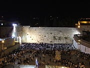
The Western Wall, known as the Kotel

clip_image003

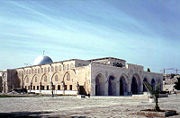
The al-Aqsa Mosque, the third holiest place in Islam

Jerusalem plays an important role in Judaism, Christianity, and Islam. The 2000 Statistical Yearbook of Jerusalem lists 1204 synagogues, 158 churches, and 73 mosques within the city.[134] Despite efforts to maintain peaceful religious coexistence, some sites, such as the Temple Mount, have been a continuous source of friction and controversy.

clip_image004

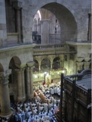
Church of the Holy Sepulchre

Jerusalem has been sacred to the Jews since King David proclaimed it his capital in the 10th century BCE. Jerusalem was the site of Solomon's Temple and the Second Temple.[6] It is mentioned in the Bible 632 times. Today, the Western Wall, a remnant of the wall surrounding the Second Temple, is a Jewish holy site second only to the Holy of Holies on the Temple Mount itself. Synagogues around the world are traditionally built with the Holy Ark facing Jerusalem and Arks within Jerusalem face the "Holy of Holies". As prescribed in the Mishna and codified in the Shulchan Aruch, daily prayers are recited while facing towards Jerusalem and the Temple Mount. Many Jews have "Mizrach" plaques hung on a wall of their homes to indicate the direction of prayer.

clip_image001[8]
Western wall of Jerusalem
by Wayne McLean, http://commons.wikimedia.org/wiki/Image:Western_wall_jerusalem_night.jpg, used under Creative Commons Attribution ShareAlike 2.0 License

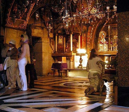
Christianity reveres Jerusalem not only for its Old Testament history but for its significance in the life of Jesus. According to the New Testament, Jesus was brought to Jerusalem soon after his birth and later in his life cleansed the Second Temple. The Cenacle, believed to be the site of Jesus' Last Supper, is located on Mount Zion in the same building that houses the Tomb of King David.Another prominent Christian site in Jerusalem is Golgotha, the site of the crucifixion. The Gospel of John describes it as being located outside Jerusalem,[143] but recent archaeological evidence suggests Golgotha is a short distance from the Old City walls, within the present-day confines of the city.[144] The land currently occupied by the Church of the Holy Sepulchre is considered one of the top candidates for Golgotha and thus has been a Christian pilgrimage site for the past two thousand years.

clip_image002
Golgotha Hill, inside the Church of the Holy Sepulchre
by Wayne McLean, http://commons.wikimedia.org/wiki/Image:Golgotha_hill.jpg, and used under Creative Commons Attribution ShareAlike 2.0 License

Jerusalem is considered the third-holiest city in Islam.[7] For approximately a year, before it was permanently switched to the Kabaa in Mecca, the qibla (direction of prayer) for Muslims was Jerusalem. The city's lasting place in Islam, however, is primarily due to Muhammad's Night of Ascension (c. 620 CE). Muslims believe Muhammad was miraculously transported one night from Mecca to the Temple Mount in Jerusalem, whereupon he ascended to Heaven to meet previous prophets of Islam. The first verse in the Qur'an's Surat al-Isra notes the destination of Muhammad's journey as al-Aqsa (the farthest) mosque, in reference to the location in Jerusalem. Today, the Temple Mount is topped by two Islamic landmarks intended to commemorate the event — al-Aqsa Mosque, derived from the name mentioned in the Qur'an, and the Dome of the Rock, which stands over the Foundation Stone, from which Muslims believe Muhammad ascended to Heaven.

clip_image001[12]
The Western Wall with the Dome on the Rock in the background, Jerusalem.
by Nadavspi, http://commons.wikimedia.org/wiki/Image:WestWall-dome.jpg, and used under Creative Commons Attribution ShareAlike 1.0 License


Transportation

clip_image005

clip_image002[3]

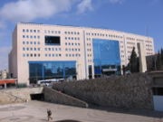
Jerusalem's Central Bus Station

The airport nearest to Jerusalem is Atarot Airport, which was used for domestic flights until its closure in 2001. Since then it has been under the control of the Israel Defense Forces due to disturbances in Ramallah and the West Bank. All air traffic from Atarot was rerouted to Ben Gurion International Airport, Israel's largest and busiest airport, which serves nine million passengers annually.

Egged Bus Cooperative, the second-largest bus company in the world, handles most of the local and intercity bus service out of the city's Central Bus Station on Jaffa Road near the western entrance to Jerusalem from highway 1. As of 2008, Egged buses, taxicabs and private cars are the only transportation options in Jerusalem. However, this will change with the completion of the Jerusalem Light Rail, a new rail-based transit system currently under construction. The rail system will be capable of transporting an estimated 200,000 people daily. It will have 24 stops, and is scheduled for completion in January 2009.

clip_image006

clip_image002[4]

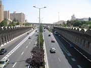
Begin Expressway.

Another work in progress is a new high-speed rail line from Tel Aviv to Jerusalem, which is scheduled to be completed in 2011. Its terminus will be an underground station (80m deep) serving the national Convention centre and the Central Bus Station, and is planned to be extended eventually to Malha station. Israel Railways operates train services to Malha train station from Tel Aviv via Beit Shemesh.

Begin Expressway is one of Jerusalem's major north-south thoroughfares; it runs on the western side of the city, merging in the north with Route 443, which continues toward Tel Aviv. Route 60 runs through the center of the city near the Green Line between East and West Jerusalem. Construction is progressing on parts of a 35-kilometer (22-mile) ring road around the city, fostering faster connection between the suburbs. The eastern half of the project was conceptualized decades ago, but reaction to the proposed highway is still mixed.

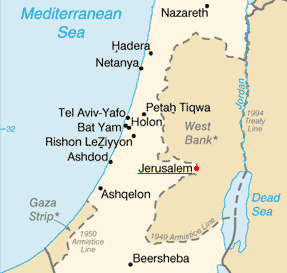
Map of Jerusalem

Image:Jerusalem Israel Map.png

Mecca , Saudi Arabia

Mecca IPA: /ˈmɛkə/, also spelled Makkah IPA: [ˈmækə] (in full: Makkah Al-Mukarramah IPA: [(Arabic) mækːæ(t) ælmʊkarˑamæ]; Arabic: مكّة المكرمة‎, literally: Honored Mecca) is Islam's holiest city and home to the Kaaba shrine and the Grand Mosque. The city is known for the annual Hajj pilgrimage, which being one of the five pillars of Islam, attracts close to 3 million pilgrims every year.


Islamic tradition attributes the beginning of Mecca to Ishmael's descendants. In the 7th century, the Islamic prophet Muhammad proclaimed Islam in the city, by then an important trading center, and the city played an important role in the early history of Islam. After 966, Mecca was led by local sharifs, until 1924, when it came under the rule of the Saudis.[1] In its modern period, Mecca has seen a great expansion in size and infrastructure.

The modern day city is located in and the capital of Saudi Arabia's Makkah Province, in the historic Hejaz region. With a population of 1,700,000 (2008), the city is located 73 kilometres (45 miles) inland from Jeddah, in a narrow valley, and 277 metres (910 ft) above sea level.
clip_image002
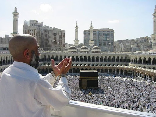
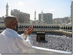
Supplicating pilgrim at the Masjid al-Haram in Mecca, Saudi Arabia
by Ali Mansuri, http://commons.wikimedia.org/wiki/Image:Supplicating_Pilgrim_at_Masjid_Al_Haram._ used under Creative Commons Attribution ShareAlike 2.5 License
clip_image003
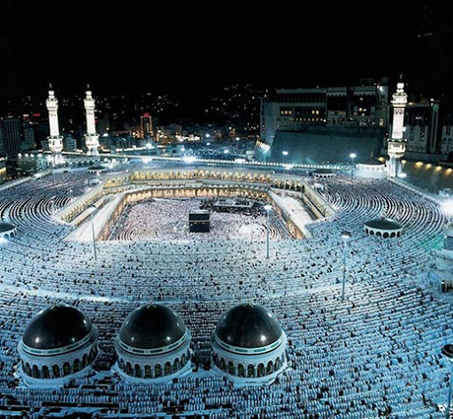
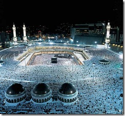
Sea of pilgrims in the Masjid al-Haram
Copyright by Mohammad Suman Hossain, http://commons.wikimedia.org/wiki/Image:Mecca_skyline.jpg.

Early history

According to Islamic tradition, the history of Mecca goes back to Ibrahim (ابراهيم, Abraham) when he built the Kaaba with the help of his son Ismā'īl (اسماعيل, Ishmael), around 2000 BC. The inhabitants were stated to have fallen away from monotheism through the influence of the Amelkites. Historians state that the Kaaba later became the repository of 360 idols and tribal gods of all of Arabia's nomadic tribes. Until the 7th century, Mecca's most important god would remain to be Hubal, having been placed there by the ruling Quraysh tribe.

The city was also known to Ptolemy as "Macoraba". In the 5th century, the Quraysh tribe took control of Mecca, and became skilled merchants and traders. In the 6th century they joined the lucrative spice trade as well, since battles in other parts of the world were causing trade routes to divert from the dangerous sea routes to the relatively more secure overland routes. The Byzantine Empire had previously controlled the Red Sea, but piracy had been on the increase. Another previous route, that from the Persian Gulf via the Tigris and Euphrates rivers, was also being threatened by exploitation from the Sassanid Empire, as well as being disrupted by the Lakhmids, the Ghassanids, and the Roman-Persian Wars. Mecca's prominence as a trading center surpassed the cities of Petra and Palmyra.

clip_image002[4]
Cave of Hira is notable for being the location where Muslims believe Muhammad received his first revelations from Allah through the angel Gabriel
by Nazli, http://commons.wikimedia.org/wiki/Image:Cave_Hira.jpg, and available in the public domain

By the middle of the 6th century, there were three major settlements in northern Arabia, all along the southwestern coast that borders the Red Sea, in a habitable region between the sea and the great desert to the east. This area, known as the Hejaz, featured three settlements that had grown around oases, where water was available. In the center of the Hejaz was Yathrib, later renamed as Medina. 250 miles (400 km) south of Yathrib was Taif, a mountain town, and northwest of Taif was Mecca. Though the area around Mecca was completely barren, Mecca was the wealthiest and most important of the three settlements. Islamic histories state that it had abundant water via the Zamzam Well, which was the site of the holiest shrine in Arabia, the Kaaba, and was also at the crossroads of major caravan routes.. Actually the well of Zamzam was barely sufficient to support the small community there, the Kaaba was but one of many such Arabian Polytheistic temple found in the peninsula, and the city was the terminus for a single caravan route which ran from Mecca to Syria.

The harsh conditions of the Arabian peninsula usually meant a constant state of conflict between the tribes, but once a year they would declare a truce and converge upon Mecca in an annual pilgrimage. This journey was intended for religious reasons, to pay homage to the shrine, and to drink from the Well of Zamzam. However, it was also the time each year that disputes would be arbitrated, debts would be resolved, and trading would occur at Meccan fairs. These annual events gave the tribes a sense of common identity and made Mecca extremely important throughout the peninsula.

Muhammad's great-grandfather had been the first to equip a camel caravan, and they became a regular part of the town's economy. Alliances were struck between the merchants in Mecca, and the local nomadic tribes, who would bring leather, livestock, and metals which were mined in the local mountains. Caravans would then be loaded up in Mecca, and would take the goods to the cities in Syria and Iraq.[18] Islamic tradition claims that goods from other continents also flowed through Mecca. From Africa and the Far East towards Syria supposedly flowed spices, leather, drugs, cloth, and slaves; and in return Mecca was to have received money, weapons, cereals, and wine, which were distributed throughout Arabia. The Meccans signed treaties with both the Byzantines and the Bedouins, and negotiated safe passage for caravans, which included such things as water and pasture rights. These further increased Mecca's political power as well as economic, and Mecca became the center of a loose confederation of client tribes, which included those of the Banu Tamim. Other forces such as the Abyssinian, Ghassan, and Lakhm were in decline, and Meccan influence was the primary binding force in Arabia in the late 6th century.

clip_image001[4]
Stoning of the Devil Ritual
by Amellie, http://commons.wikimedia.org/wiki/Image:Amellie_-_Stoning_of_the_devil_2006_Hajj.jpg, used under Creative Commons Attribution 2.0 License


clip_image002[6]
The Kaaba, Masjid al-Haram, Mecca
by Muhammad Mahdi Karim, http://commons.wikimedia.org/wiki/Image:Kaaba_Mirror_like.jpg, used under GNU Free Documentation License

Cityspaces

See also: Masjid al-Haram

Mecca houses the Masjid al-Haram, the largest mosque in the world. The mosque surrounds the Kaaba, the place which Muslims turn towards while offering daily prayer and considered by Muslims to be the holiest place on Earth. The mosque is also commonly known as the Haram or Grand Mosque.

clip_image001[6]
Masjid al-Haram in May 2007, Mecca
by Micro Jay, http://en.wikipedia.org/wiki/Image:Makkeh.jpg, available in the public domain

The current structure covers an area of 356,800 square meters including the outdoor and indoor praying spaces and can accommodate up to 4 million worshippers during the Hajj period.
clip_image001

clip_image002

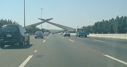
The Mecca archway, shaped like an open Qur'an, marks the point beyond which only Muslims may enter.[30]

The recent expansion of the city provided many modern landmarks such as the huge towers of Abraj Al-Bait, with height of 577 m (1,893 ft).[31] The construction of the towers will be completed in 2009, being one of the world's tallest buildings. The site of the towers is located across the street from the entrance to the Grand Mosque.

As a historic city, Mecca owns hundreds of historical landmarks such as the Kaaba, Muslims believe it was built by Abraham and his son Ishmael. The Zamzam Well is a further example.

The Qishla of Mecca used to be one of the most notable structures for Mecca, The Qishla was an Ottoman castle facing the Grand Mosque and defending the city from any possible attack. However, the Saudi government removed the structure, giving free space for new hotels and business buildings around the Mosque.[32]

Transportation

Transportation facilities related to the Hajj or Umrah are the main services available. Mecca has only the small Mecca East Airport with no airline service, so most pilgrims access the city through the Hajj terminal of King Abdulaziz International Airport (JED) or the Jeddah Seaport, both of which are in Jeddah.

The city lacks any public transportation options for residents and visitors, both during and outside of the pilgrimage season. The main transportation options available for travel within and around the city are either personal vehicles or private taxis.

Map of Mecca

Location of Mecca

Location of Mecca

Abu Simbel, Egypt

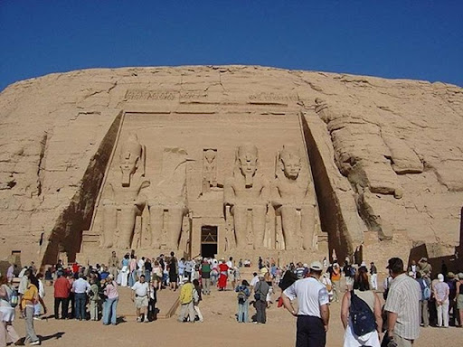
Abu Simbel Temple is one of the most famous ancient Egyptian temples in the world. Today a major tourist attraction, although located a distance from Cairo, Abu Simbel attracted world attention in the 1960's, when the construction of the Aswan High Dam threatened to submerge it.


In order to save Abu Simbel Temple, Unesco embarked on a rescue mission. The archaeological project to relocate Abu Simbel to higher ground became a colossal project involving experts from many countries. Eventually Abu Simbel was relocated to an artificial mountain that is empty on the inside, but looks like a real mountain from outside. The name Abu Simbel is believed to be that of an early guide who brought the first archaeologists to the place. The temple was constructed in approximately 1284BC by Pharoah Ramesses II as a monument to himself and to his queen Nefertari, purportedly to commemorate his victory against the Hittites in the Battle of Kadesh. There are therefore two temples, one for Ramesses II and another to Nefertari, located next to each other. The location chosen by Ramesses for his temple is at the southern gateway into Egypt and serves as a billboard to intimidate his Nubian neighbours and to advertise his might. What better way to frighten your foes than to erect such monumental statues of yourself.

clip_image001
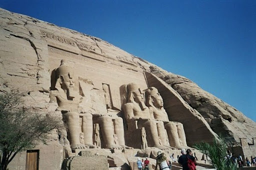
Abu Simbel Temple
by Marion Golsteijn, http://commons.wikimedia.org/wiki/Image:Aboe_Simbel_Tempel_Ramses_II.jpg, used under GNU Free Documentation License


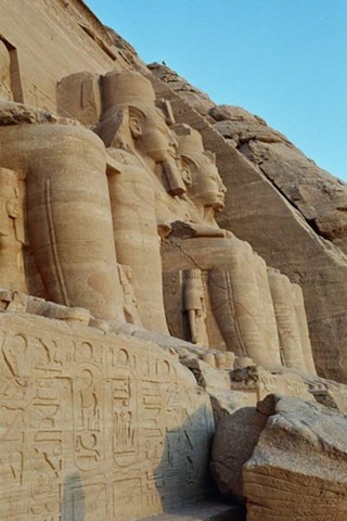
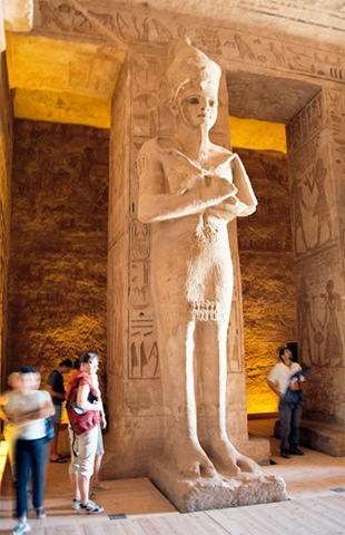
The two temples at Abu Simbel are called the Greater Temple and the Lesser Temple. The Greater Temple was dedicated to the ancient Egyptian gods Amun Ra, Ra Harakhti and Ptah, and the deified Ramesses himself. It consists of four colossal statues in seated position each towering 20 metres in height. All of them depict Pharoah Ramesses II. The statues were carved out of the rock where they were located. Members of the royal family are also sculptured below Ramesses. Standing no higher than the Pharoah's knees include Nefertari, queen mother Mut-Tuy, sons Amun-her-khepeshef and Ramesses, and daughters Bintanath, Baketmut, Nefertari, Meritamen, Nebettawy and Isetnofret.

clip_image001[4]
Close up of the colossi of Abu Simbel
by Bionet, http://commons.wikimedia.org/wiki/Image:Abou_simbel_pharaons.jpg, available in the public domain


clip_image003
Abu Simbel Temple vertical view
by JoSchmaltz, http://commons.wikimedia.org/wiki/Image:Abu-Simbel_temple1.jpg, used under Creative Commons Attribution ShareAlike 2.0 License


Going through the doorway between the colossal statues, one enters the hypostyle hall, an elongated chamber 18 metres long and 16.7 metres wide. This hall is supported by pillars that depict the deified Ramesses linked to the god Osiris. At the end of the hypostyle hall is a second pillared chamber. From here a vestibule leads to the sanctuary. Seated within the sanctuary are four seated figures, namely Ra Harakhti, the deified Ramesses, Amun Ra and Ptah. The Greater Temple is constructed in such a way that every year, on 20 October and 20 February, the ray of the sun would penetrate the sanctuary and illuminate three of the four seated figures; Ptah, the god of the underworld, remains permanently in darkness. The two dates are believed to commemorate the pharoah's birthday and coronation, or perhaps some other great even, such as the thirtieth jubilee of his reign. When archaeologists moved the temple, they tried to re-create the event. However, their calculations must have been out by a bit, for the rays now enters the sanctuary a day later.

clip_image001[6]
Abu Simbel complex: to the left is the temple of Ramesses II, to the right is the temple of his wife, Nefertari
by Przemyslaw "Blueshade" Idzkiewicz, http://commons.wikimedia.org/wiki/Image:Abu_Simbel%2C_both_temples%2C used under Creative Commons Attribution ShareAlike 2.0 License

clip_image002
Corridor statue at Abu Simbel Temple
by Przemyslaw "Blueshade" Idzkiewicz, http://commons.wikimedia.org/wiki/Image:Abu_Simbel%2C_Ramesses_Temple%2C_


clip_image004
Tourists at Abu Simbel Temple
by Ninlil, http://commons.wikimedia.org/wiki/Image:Ebu_simbel1.jpg, used under GNU Free Documentation License

One hundred meters away from the Greater Temple is the Lesser Temple, dedicated to Ramesses II's chief queen Nefertiti and the goddess Hathor. The façade, also carved from the rocks, show two groups of 10-meter tall colossi. Here, the king and queen are shown of equal size. This is very unusual, because traditionally the queen is never shown any taller than the pharoah's knees. The Lesser Temple is a rare example where both king and queen are depicted in equal size, and is also the only example of a temple dedicated to the king's consort.

clip_image002[4]
Temple of Nefertari, Abu Simbel
by Luck-One, http://commons.wikimedia.org/wiki/Image:MyAbu_Simbel.jpg, used under Creative Commons Attribution ShareAlike 2.5 License


clip_image003[4]
Close up of the Nefertari Temple at Abu Simbel
by Marion Golsteijn, http://commons.wikimedia.org/wiki/Image:Tempel_Nefertari.JPG, used under GNU Free Documentation License


In 1959, the Abu Simbel temple faced a modern threat in the form of the planned construction of the Aswan High Dam, which threatened to inundate it. This propelled the international community to start a campaign to it. With the participation of Unesco, a project was formed to move the temple. The salvage operation began in 1964. The temple was carefully dismantled block by block. Each block was numbered and then moved to a location 64m higher and 200m away from the rising water. It was through this project that the idea to safeguard the world heritage was mooted, and through this, the Unesco World Heritage Site listing was born.
Abu Simbel can be reached by flight from Cairo. At time of writing (Dec 2007), Egyptian Air flies four times a day. Another possible way to reach Abu Simbel is by boat through Lake Nasser. Due to security concerns, Abu Simbel is presently not accessible by car to foreigners. Anyone wishing to visit Abu Simbel by road must join a tour convoy. These convoys are escorted by police. Check with the Egyptian tourist office before making plans. There are usually at least one convoy per day. The trip takes 3 hours each way. Bring sunblock and water, as the journey is very hot. It is also advisable to travel on air-conditioned buses.
Abu Simbel Temple was declared a Unesco World Heritage Site in 1979, listed under Nubian Monuments.


Petra , Jordania

Petra (from "petra", rock in Greek; Arabic: البتراء, Al-Batrāʾ) is an archaeological site in the Arabah, Ma'an Governorate, Jordan, lying on the slope of Mount Hor[1] in a basin among the mountains which form the eastern flank of Arabah (Wadi Araba), the large valley running from the Dead Sea to the Gulf of Aqaba. It is renowned for its rock-cut architecture. Petra is also one of the new wonders of the world.


The site remained unknown to the Western world until 1812, when it was discovered by Swiss explorer Johann Ludwig Burckhardt. It was famously described as "a rose-red city half as old as time" in a Newdigate prize-winning sonnet by John William Burgon. UNESCO has described it as "one of the most precious cultural properties of man's cultural heritage."[2] In 1985, Petra was designated a World Heritage Site.
is an ancient name for Petra and appears in Dead Sea scrolls[3] associated with Mount Seir. Additionally, Eusebius and Jerome[4] assert that Rekem was the native name of Petra, supposedly on the authority of Josephus.[5] Pliny the Elder and other writers identify Petra as the capital of the Nabataeans, Aramaic-speaking Semites, and the centre of their caravan trade. Enclosed by towering rocks and watered by a perennial stream, Petra not only possessed the advantages of a fortress but controlled the main commercial routes which passed through it to Gaza in the west, to Bosra and Damascus in the north, to Aqaba and Leuce Come on the Red Sea, and across the desert to the Persian Gulf. The latitude is 30° 19' 43" N and the longitude is 35° 26' 31" E.


The end of the Siq
Excavations have demonstrated that it was the ability of the Nabataeans to control the water supply that led to the rise of the desert city, in effect creating an artificial oasis. The area is visited by flash floods and archaeological evidence demonstrates the Nabataeans controlled these floods by the use of dams, cisterns and water conduits. These innovations stored water for prolonged periods of drought, and enabled the city to prosper from its sale.


The Theatre
Although in ancient times Petra might have been approached from the south (via Saudi Arabia on a track leading around Jabal Haroun, Aaron's Mountain, on across the plain of Petra), or possibly from the high plateau to the north, most modern visitors approach the ancient site from the east. The impressive eastern entrance leads steeply down through a dark, narrow gorge (in places only 3–4 metres wide) called the Siq ("the shaft"), a natural geological feature formed from a deep split in the sandstone rocks and serving as a waterway flowing into Wadi Musa. At the end of the narrow gorge stands Petra's most elaborate ruin, Al Khazneh ("the Treasury"), hewn into the sandstone cliff.


The Monastery at Petra

A little further from the Treasury, at the foot of the mountain called en-Nejr is a massive theatre, so placed as to bring the greatest number of tombs within view. At the point where the valley opens out into the plain, the site of the city is revealed with striking effect. The amphitheatre has actually been cut into the hillside and into several of the tombs during its construction. Rectangular gaps in the seating are still visible. Almost enclosing it on three sides are rose-colored mountain walls, divided into groups by deep fissures, and lined with knobs cut from the rock in the form of towers.